This was situated to the south of Birmingham, off the A34 Stratford Road. There is more information about its last days here.
From what my father (Henry Allerton) told me, planning restrictions were relaxed after the First World War, in order to encourage people to build their own houses, and The Mount was one of the areas that developed as a result.
Initially Grandfather used his plot (Ľ acre I believe) for growing vegetables, and built a toolshed, that gradually expanded to weekend accommodation, and then on to a permanent residence. It was built of some brick, but mainly wood and asbestos sheeting, with a shallow-pitch felt roof.
Granny lived there a total of about 50 years!
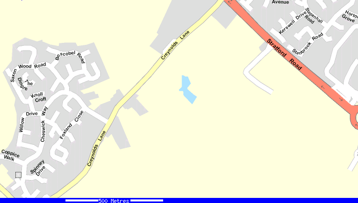
These are modern maps of the area, and much has doubtless changed since I knew it. The Mount has apparently disappeared without trace, but would appear to have occupied at least a part of the modern housing estate to the left of this map (Cheswick Green):
The map below shows a wider area, including Salter Street School, (in the centre of the map, at the bottom, next to the church) attended by the children of the family, and my brother Nick and myself when we lived with Granny for several months (between houses) in 1956.

The route to school took us along the rough road in the Mount Estate, and down onto Creynolds Lane. We crossed Watery Lane (which I remember had a blacksmith's a short way along it to the right), and up a hill (more of a slope) to join Salter Street. It was about a mile, nothing of any consequence at that time, as long as you had a pair of shoes of course! This wasn't always the case. The stream shown as the River Blythe was actually fairly small, and we used to play in it sometimes. The canal is also visible on this map, and there were some header lakes to the south of this map ("Earlswood Lakes") where we used go to play sometimes.
The usual route from Birmingham to the Mount was down the A34 (the Stratford Road) to the Crown Hotel, then turn right up Creynolds Lane, and right into the Mount. We usually took the bus, got off at the Crown and walked about ˝ mile up Creynolds Lane.
However, the buses that took this route were not that frequent, and there was a more frequent service that went down Stratford Road to the George & Dragon, where it turned left into Solihull (shown by a red circle below). This was also cheaper (a matter of pence, but a consideration in those days). We would sometimes take this route, and would walk across the fields to the Mount. I remember this as something of an adventure! We probably joined the public footpath shown, but I am not sure of the exact route before this.
